Navionics
 Navionics has the world’s largest database of marine and lake charts, covering the salt waters of the entire planet as well as tens of thousands of lakes and rivers. Many of these charts have been developed by way of Navionics’ proprietary surveys done both in the field and with remote sensing such as satellite imagery and airborne laser scanners.
-
 Navionics
 Platinum+™ - Bay of Biscay - NPEU008R
$339.99
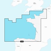
Navionics
Navionics Platinum+™ - Bay of Biscay - NPEU008R
$339.99
-
 Navionics
 Platinum+™ - Ireland, West Coast - NPEU075R
$339.99
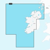
Navionics
Navionics Platinum+™ - Ireland, West Coast - NPEU075R
$339.99
-
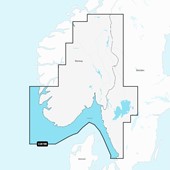
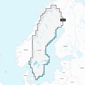
 Navionics
 Platinum+™ - Norway, Vestfjd to Svalbard...
$339.99
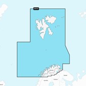
Navionics
Navionics Platinum+™ - Norway, Vestfjd to Svalbard...
$339.99
-
 Navionics
 Platinum+™ - Norway, Sognefjorden to Svesfjorden...
$339.99
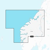
Navionics
Navionics Platinum+™ - Norway, Sognefjorden to Svesfjorden...
$339.99
-
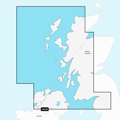 Navionics
 Platinum+™ - Scotland, West Coast - NPEU006R
$339.99
Navionics
Navionics Platinum+™ - Scotland, West Coast - NPEU006R
$339.99
-
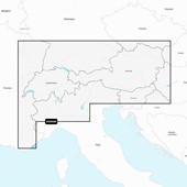
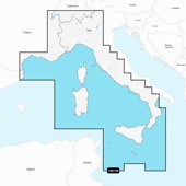
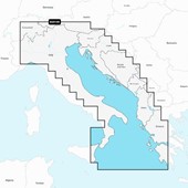 Navionics
 Platinum+™ - Italy, Adriatic Sea - NPEU014R
$339.99
Navionics
Navionics Platinum+™ - Italy, Adriatic Sea - NPEU014R
$339.99
-
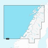 Navionics
 Platinum+™ - Norway, Trondheim to Tromso...
$339.99
Navionics
Navionics Platinum+™ - Norway, Trondheim to Tromso...
$339.99
-
 Navionics
 Platinum+™ - Sweden, Southeast - NPEU079R
$339.99
Navionics
Navionics Platinum+™ - Sweden, Southeast - NPEU079R
$339.99
-
 Navionics
 Platinum+™ - Germany - NPEU060R
$339.99
Navionics
Navionics Platinum+™ - Germany - NPEU060R
$339.99
-
 Navionics
 Platinum+™ - Oslo, Skagerrak & Haugesund...
$339.99
Navionics
Navionics Platinum+™ - Oslo, Skagerrak & Haugesund...
$339.99
-
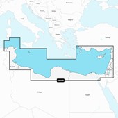 Navionics
 Platinum+™ - Mediterranean Sea Southeast...
$339.99
Navionics
Navionics Platinum+™ - Mediterranean Sea Southeast...
$339.99
-
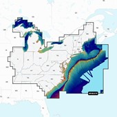 Navionics
 Platinum+™ - U.S. East - NPUS007R
$339.99
Navionics
Navionics Platinum+™ - U.S. East - NPUS007R
$339.99
-
 Navionics
 Platinum+™ - Alpine Lakes - NPEU066R
$339.99
Navionics
Navionics Platinum+™ - Alpine Lakes - NPEU066R
$339.99
-
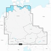
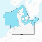 Navionics
 Platinum+™ - Denmark, Germany & Coastal Poland...
$339.99
Navionics
Navionics Platinum+™ - Denmark, Germany & Coastal Poland...
$339.99
-
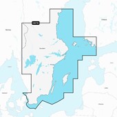
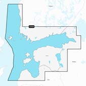
 Navionics
 Platinum+™ - Gulf of Bothnia - NPEU047R
$339.99
Navionics
Navionics Platinum+™ - Gulf of Bothnia - NPEU047R
$339.99
-
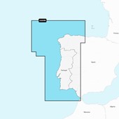 Navionics
 Platinum+™ - Portugal & Spain, Northwest...
$339.99
Navionics
Navionics Platinum+™ - Portugal & Spain, Northwest...
$339.99
-
 Navionics
 Platinum+™ - Mediterranean Sea, Central and...
$339.99
Navionics
Navionics Platinum+™ - Mediterranean Sea, Central and...
$339.99
-
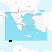 Navionics
 Platinum+™ - Aegean Sea, Sea of Marmara -...
$339.99
Navionics
Navionics Platinum+™ - Aegean Sea, Sea of Marmara -...
$339.99
-
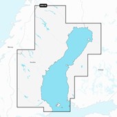
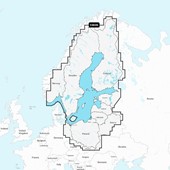
 Navionics
 Platinum+™ - Sweden - NPEU067R
$339.99
Navionics
Navionics Platinum+™ - Sweden - NPEU067R
$339.99
-
 Navionics
 Platinum+™ - Gulfs of Finland and Riga -...
$339.99
Navionics
Navionics Platinum+™ - Gulfs of Finland and Riga -...
$339.99
-
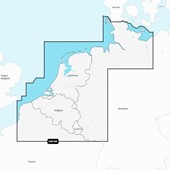 Navionics
 Platinum+™ - Benelux & Germany, West - NPEU076R
$339.99
Navionics
Navionics Platinum+™ - Benelux & Germany, West - NPEU076R
$339.99
-
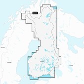 Navionics
 Platinum+™ - Finland - NPEU055R
$339.99
Navionics
Navionics Platinum+™ - Finland - NPEU055R
$339.99
-
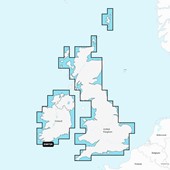 Navionics
 Platinum+™ - U.K. & Ireland - NPEU072R
$339.99
Navionics
Navionics Platinum+™ - U.K. & Ireland - NPEU072R
$339.99
-
 Navionics
 Platinum+™ - Baltic Sea - NPEU644L
$479.99
Navionics
Navionics Platinum+™ - Baltic Sea - NPEU644L
$479.99