Accessories available for this product
-
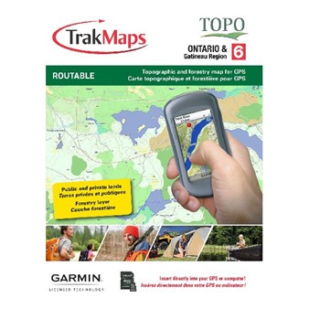
TrakMaps Topo Ontario - SD/MicroSD: Garmin $129.99 Accessories available View accessories
For Garmin units only
- New - Crown and private lands

- New - Forestry layer (forest resources inventory)
- New - Paddling routes
- New - Bike paths
- New - Updated routable forestry roads
- New - Updated trailheads and trails
- New - Updated routable road network
- Complete coverage of Ontario + the Outaouais region*
- 3D digital elevation model
- Topographic data including mountains, hills, valleys, lakes, rivers, streams, wetlands, forest zones
- Wildlife Management Unit (WMU) boundaries
- Fisheries Management Zones
- Detailed shorelines of 250,000+ lakes and rivers, rock locations
- Wildlife reserves, national, provincial, municipal parks
- Buildings, pylons, electric lines, bridges, dams, railroads, other reference points & landmarks
- Snowmobile and ATV trails (non routable)*
- Campsites and picnic areas
- Fishing spots, dive sites and marked shipwrecks
- Boat launch ramps and marinas
- Cellular towers
- Trail amenities: parking, wash-rooms, potable water, visitor centres and more
- Buildings, pylons, electric lines, bridges, dams, railroads, other reference points and landmarks
- POIs including lodging, restaurants, gas stations & ATMs
* Unofficial trails included for identification purposes only. We strongly recommend that snowmobile and ATV users acquire the official, federated trails available in TrakMaps ATV Ontario and Snowmobile Ontario.
Compatible with these products
-
TrakMaps Topo Ontario - SD/MicroSD: Garmin $129.99 Accessories available View accessories
-
Garmin Rino® 700 2 Watts FRS/GMRS Canadian Version $469.99 Accessories available View accessories
-
Garmin eTrex® 22x $279.99 Accessories available View accessories
-
Garmin eTrex® 32x $399.99 Accessories available View accessories
-
Garmin Montana® 750i $1079.99 Accessories available View accessories
-
Garmin GPSMAP 65 $469.99 Accessories available View accessories
-
Garmin GPSMAP 65s $539.99 Accessories available View accessories

